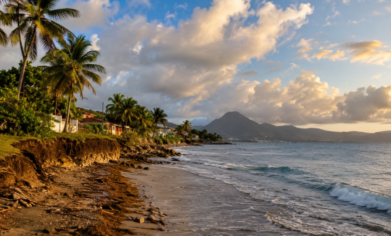
What will Martinique’s coastal areas look like in 30, 50, or 100 years? This question is gradually being incorporated into land-use planning tools. In its 2025 activity report, DEAL Martinique details work undertaken with local governments to better document coastal erosion and incorporate this trend into land-use planning decisions. The assessment does not provide an exhaustive map of Martinique’s entire coastline. However, it shows how proactive planning is beginning to take shape across several regions, from the north to the south of the island.
—
Projections that look up to 100 years ahead
One of the key points of the report concerns the time frame used. The projects discussed are not limited to areas already affected by erosion. They aim to identify areas likely to be at risk of coastal retreat in the coming decades.
Two types of horizons are distinguished: areas exposed to 30 years and those whose exhibition is scheduled to take place between 30 and 100 years.
This change in scale is crucial for land-use planning. A decision made today regarding urban development, the construction of a facility, or the future of a coastal area can shape the region for several decades. Maps must therefore help local governments incorporate future trends into documents that are often used to guide long-term decisions.
In its report, the DEAL directly links this initiative to climate change adaptation and urban planning. The stated goal is to’support local governments with land and financial tools in order to better account for coastal erosion in their planning documents.
In the North, 13 maps to document changes along the coastline
Work has already begun in the Cap Nord area. The report identifies 13 maps showing coastal erosion developed for the 11 coastal municipalities of the territory.
These documents provide a knowledge base intended to inform local decision-making. Their value extends beyond simply representing risk: They can help identify areas where land-use decisions will need to take into account gradual changes to the coastline.
The distinction between 30-year and 30- to 100-year time horizons also makes it possible to distinguish between different time frames.
Not all areas are exposed in the same way or at the same time. For local governments, the challenge is therefore to develop a sufficiently nuanced understanding to prepare for future decisions without confusing immediate risk with long-term trends.
The DEAL activity report provides information here on the progress of mapping and support efforts. This does not mean that all adaptation measures have already been defined or implemented in the municipalities concerned.
Following the North, the initiative is being expanded to the South Region
In 2025, the government also continued to provide support for the development of local maps on 10 municipalities in Espace Sud. The DEAL states that it co-financed the study in the amount of 85,000 euros.
This new phase is intended to identify areas at risk of coastal erosion over the same time frames and to provide local governments with useful information for developing their land-use plans.
The extension of this approach to the South shows that taking into account Coastal changes are no longer confined to a single intermunicipal area.
However, it would be premature to view this as a fully developed adaptation strategy for the entire island of Martinique. The report primarily describes an ongoing process, with varying levels of progress across different regions.
This distinction is important: Gaining an understanding of the risk is a preliminary step. Translating that understanding into land-use policies is another.
When Coastal Retreat Is Included in Urban Planning Documents
That is probably where the main challenge lies. Mapping possible changes to the coastline is not enough if that knowledge has no impact on land-use decisions.
Land-use planning documents can designate areas suitable for development, regulate land use, and guide the future development of municipalities. Incorporating 30- or 100-year projections therefore raises practical questions : Where should we continue to build? Which areas should we preserve? How can we anticipate changes in already urbanized areas? Which facilities might become more vulnerable over time?
The DEAL report does not provide a uniform answer to these questions. Rather, it highlights the gradual development of tools designed to help communities chart their own paths.
This approach is particularly important in an island region where land constraints are significant. Adaptation decisions cannot be separated from housing needs, infrastructure, economic activities, the protection of natural environments, or the attractiveness of coastal areas.
Coastal erosion thus becomes a planning issue in its own right, and no longer just an environmental issue.
From Risk Awareness to Concrete Decisions
The projects identified in 2025 mark a step forward in understanding and foresight. However, they are only part of the journey.
A map alone does not protect a road, a neighborhood, or a facility. It helps identify potential risks, better inform decision-making, and prevent decisions from being made without taking expected changes into account.
The transition to full implementation then depends on several factors: iIncorporation into urban planning documents, land-use decisions, financial capacity, coordination among public stakeholders, and public acceptance of decisions.
As the deadline approaches, some communities may face more complex decisions regarding the use and future development of exposed areas.
The 2025 report does not allow us to conclude that Martinique already has a comprehensive response to these challenges. It does, however, show that a long-term perspective is beginning to be incorporated more concretely into planning tools.
Planning Today for a Coastline That Will Change
With the 13 maps identified within the Cap Nord area and the launch of the initiative across the 10 municipalities of Espace Sud, efforts to adapt Martinica’s coastline have reached a new milestone in generating knowledge that is useful to local governments.
The challenge now will be to gradually translate these projections into coherent planning decisions. After all, looking 100 years ahead is not about predicting the future with precision. Rather, it is about better preparing the decisions made today for a coastline whose contours will continue to change.
You can view it here The DEAL Martinique 2025 Annual Report